A HIKING ROOKIE'S TALE:
CLIMBING MT KILIMANJARO | THE MACHAME ROUTE IN 7 DAYS
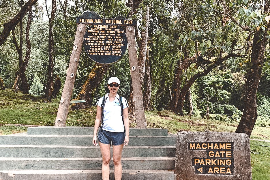
As our 4WD rolls up to Machame Gate, I feel a mild wave of panic. The hiking boots on my feet suddenly feel as heavy as lead. I’m seriously considering asking the driver to take me back to our hotel in Moshi.
I’m a city girl, at the beginning of a shiny corporate career. I’m used to wearing pencil skirts and stilettos, crunching numbers for at least 10 hours a day on the 48th floor of a CBD skyscraper. Today, six days before Christmas, I find myself about to attempt to summit the tallest mountain in Africa. No calculator is going to help me here.
I’m at the base of Mount Kilimanjaro in Tanzania, Africa. Together with my father and two other rookie mountaineers, we’re here for a 7 day hiking expedition. Mount Kilimanjaro is the tallest freestanding mountain in the world standing at 19,341 ft (5,895m) above sea level. Our journey will take us up the Machame route in 7 days, the most popular path to the summit. Otherwise known as the “Whiskey” route, the Machame route is nicknamed so given its reputation as a tough climb. Compared to the easier Marangu route (the “Coca-Cola” route), those who choose the Machame route will face steeper trails for longer distances but are rewarded with breathtaking vistas. So I’m told.
My father and I are hiking with a young American couple. We all met last night with our guides, Jerry and Bobby. The four of us are relatively inexperienced mountain climbers, but Jerry soon puts our minds at ease with his calm voice and warm eyes. We will hike as fast as the slowest person in the group. The motto for the week is “pole, pole” which translates to “slowly, slowly”. I hope I won’t move up the mountain too slowly.
The bags are unloaded from the car. Jerry wanders off to locate the rest of our team. I see men and women of all ages, fresh-faced and eager. A group of burly blond men are laughing and applying sunscreen to their faces. One woman sits on a bench and tucks her grey hair behind her ears before pulling a headband on.
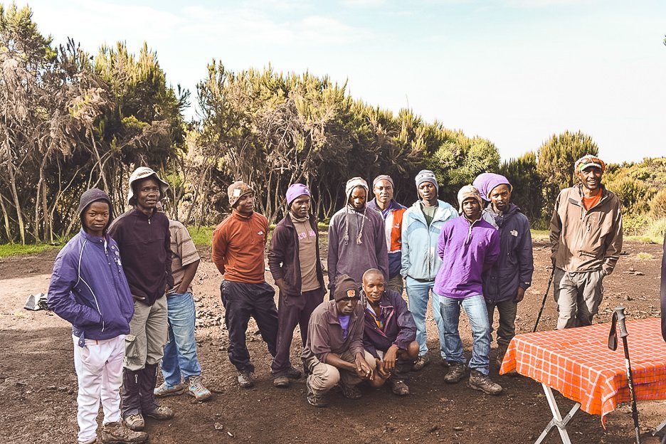
Jerry returns, followed by a band of young Tanzanian men. This is the team who is going to support us all the way up and down the mountain. Being a porter is a revered job in Tanzania. Wages are approximately USD$25/day and everyone will split the tips at the end of the journey. Despite the lure of money, the job is also a dangerous one. Often, the men climb in apparel and footwear that are of poor condition. They rely on donations left behind by visiting mountaineers.
Our bags are weighed on scales. Items are shuffled between bags to ensure that the porters are not carrying more than 20kg. I look on astounded. My small backpack can’t be more than 7kgs and already I can feel the strap digging into my shoulders.
With one final bag adjustment, Jerry cries “Let’s go!”. And we’re off.
Day 1: Machame Gate to Machame Camp
Elevation: 5,380 ft to 9,350 ft
Distance: 11 km/7 miles
We’re in high spirits when we leave Machame Gate. We will hike 11 kilometres to Machame Camp and this will take approximately 5 – 7 hours. The porters have ploughed on ahead. They will always move ahead of us to set up camp for the night.
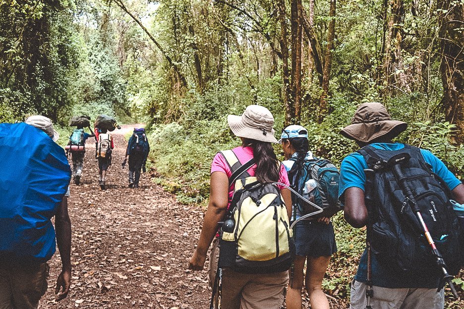
Our trail is a wide dirt track with a gradual incline. This is the beginning of our 7 day leg workout. I hope my butt will look as good as a Victoria’s Secret model by the end of this expedition. The first slope brings us to the edge of the rainforest. It’s hot and humid. It’s only been about 30 minutes and I can already feel my back sweating underneath my backpack. I vaguely remember this sticky heat feeling from a family holiday in Cairns several years ago. That sweaty stickiness has intensified five fold.
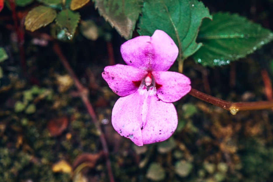
Leaves litter the path and bulbous tree trunks shrouded in silky moss loom over us. Ferns sprout up on either side of the trail. Amongst the dense greenery, our guides point out colourful flora to us, much to the excitement of my father who is an orchid hobbyist. He eagerly snaps photos of the small vibrant flowers for his archives to verify the species when we return home.
In the early afternoon, we emerge from the dense tree cover. Patches of sunshine guide us upwards. The rainforest has turned into thick bushlands. We reach Machame Camp just before dusk and our crew gives a small cheer. Day one done and dusted. Tonight, we’re sleeping at almost 10,000 ft above sea level (~3,000m). We’ve doubled our elevation since leaving Machame Gate. My legs feel a tad weary but overall, I’m feeling quite good. We gratefully wash our faces and neck with the tub of hot water placed in front of our tents before sitting down to a hearty dinner of chicken stew and rice.
My father and I are taking altitude sickness medication on this climb (half a Diamox tablet each day – prescription only). I haven’t experienced any dizziness or shortness of breath today, so I take this as a good sign. I place my asthma puffer underneath my makeshift pillow and lay down on my foam mattress, trying to block out my dad’s rhythmic snoring.
Day 2: Machame Camp to Shira 2 Camp
Elevation: 9,350 ft to 12,500 ft
Distance: 5 km/3 miles
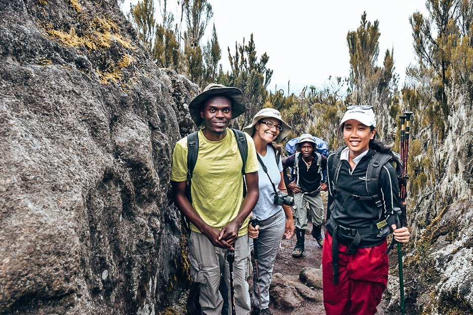
Today, we will cover a shorter distance over an elevation of around 2,500 ft (~800m). The temperature is expected to drop so I pull on a pair of track pants. Soon, the terrain changes. We’re heading into the moorlands. The flat rainforest path is replaced by rocks covered in lichen and moss. The steep ridge we follow is flanked by humongous boulders, interspersed with heather. The walking poles come out and the support straps of my backpack strain across my chest as I hoist myself upwards. For the first couple of hours, we pause to catch our breath on the trail to allow the porters to pass, laden with their loads.
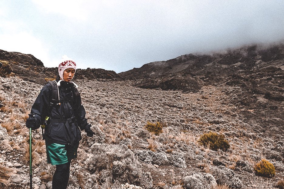
The landscape before me becomes quite eerie. I catch sight of white wispy foliage, reminiscent of Santa Claus’ beard, dangling from scrawny tree branches. Low shrubs produce brittle leaves and tufts of dry grass appear forlorn amongst the rocky terrain as we cross the little valley. In the distance, boulders shield blind curves that I soon lose sight of climbers ahead on the route. A wave of dense cloud rolls in as we continue our ascent, concealing our view of the next peak. We stop for lunch and soon we’re joined by a few black feathered friends. The white-necked ravens known in the area must be familiar with trekkers, as one perches next to my father on a rock, beadily eyeing the tea cake in his hand.
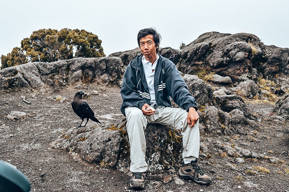
We continue into the clouds and I pull a beanie over my head. I can feel the chill numbing my ears. Jerry informs us that on a clear day, one can see the peak of Mount Meru towards the west. As we climb over the last ridge to Shira Camp, we’re greeted with an unexpected sight. A thin layer of white icing covers the ground. The icy snow crunches under out boots as we find our tents and I pray my sleeping bag will keep me warm tonight.
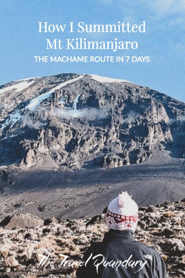
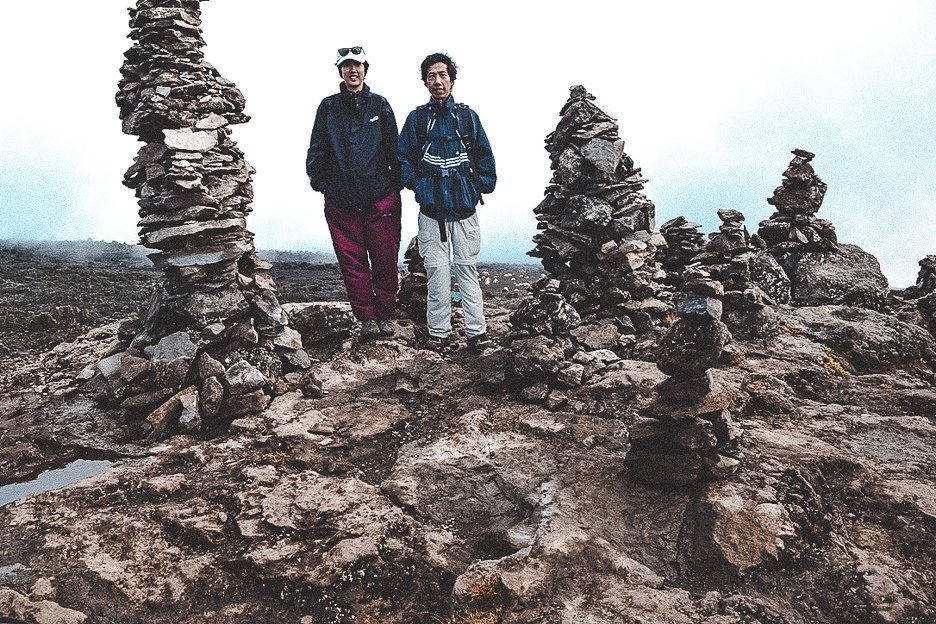
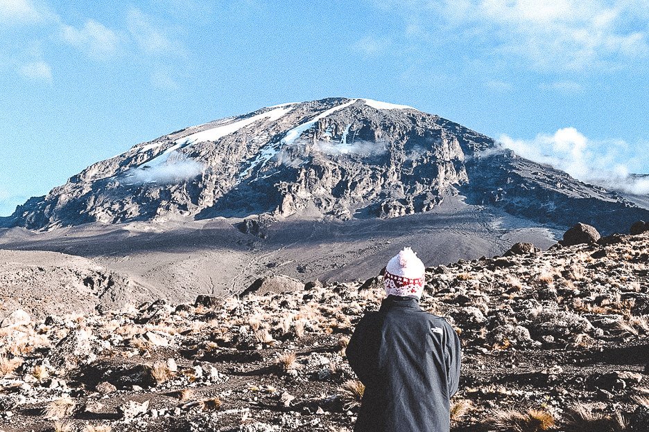
After a couple of hours rest, Jerry leads us to a lookout point not far from the campsite. Jenga block rock towers stand here, built by mountaineers who have passed through here before us. The clouds have cleared this afternoon and afforded us a clear view of Mount Kilimanjaro’s peak. It looks a long way off. How we’re going to get there in three days time is beyond me.
Day 3: Shira 2 Camp to Lava Tower to Barranco Camp
Distance: 7 km/4 miles
Elevation: 15,190 ft to 13,044 ft
Distance: 3 km/2 miles
Day 3 will be a long day of hiking. We will be following the old mountaineering adage “climb high, sleep low” to help our bodies acclimatize to the higher altitude and prepare for summit day. After breakfast, I watch our crew disassemble our campsite and notice that every single item, from tent pegs to plastic wrapping, is collected and packed away. Mt Kilimanjaro is a national park. As such, every single piece of rubbish must come down off the mountain. This includes chicken bones, plastic packaging such as glad wrap and muesli bar wrappers, face wipes – everything. The porters carry our clothes, our tents and bedding, cooking equipment, food and water as well as all the rubbish that must go off the mountain. I had noticed some fancier tents at Machame camp site and Jerry informs us that there are even some groups who have a porter who carries their own private toilet up the mountain! I’m gobsmacked. I struggle with the fact that this task is a ridiculous waste of human resources, yet it puts a man in a job and likely puts food in his belly and for his family. (If you’re planning on hiking Mt Kilimanjaro and considering what to pack, review this packing list and use it as a guide).
I have to push this thought from my mind as we set off east towards Lava Tower. The peak of Mt Kilimanjaro is again shrouded in cloud. We haven’t walked too far before the trees begin to disappear. As we begin to cross a vast plain, it starts to snow. How it can be snowing in semi-desert terrain leaves me somewhat bemused, however, I don’t have long to ponder the climate conditions as rain begins to fall. And then it starts to pour.
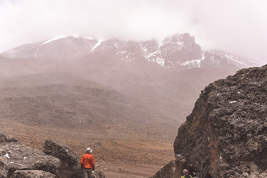
There’s a mad rush to grab ponchos out of our backpacks as the sleet rain jabs us from all directions. We’re instructed to follow our lead guide in single file. I have to keep my head turned down to avoid the water sliding from the poncho hood into my eyes. No matter how tight I tuck my sleeves into my gloves, the water seems to seep through every opening. The rain batters down and there is no shelter in sight. My hands are numb and I can feel my cheeks burn as the wind ravages around us. We eventually reach the base of Lava Tower, otherwise known as the “Shark’s Tooth”. Clusters of brightly hued jackets huddle close to the gigantic boulders, attempting to seek solace from the biting wind. It’s meant to be our lunch break but I’m unwilling to remove my gloves.
The rain is relentless. After managing a few bites of my lunch, we reluctantly head back onto the plains and plough onwards. I keep my head down and focus on placing one foot in front of the other. I repeat the words “pole, pole” over and over in my head.
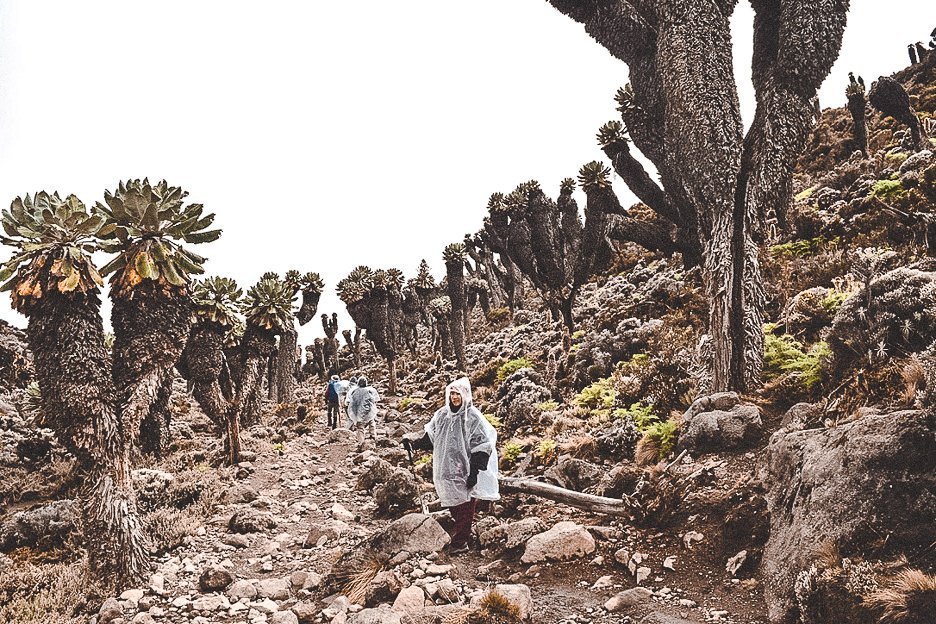
Finally, the rain stops. I hear a cry of “Hallelujah!” in the distance and the rustle of ponchos being lifted over heads. I decide to keep mine on for the time being. I’m sceptical that the rain has passed for good. The campsite is not too far now and various vegetative life forms begin to reappear. After a while, we reach the Garden of the Senecios. The huge bulbous plants seem to rise out of the earth like a hairy monster from another planet. Bulky branches protrude from the furry trunks and flat, fan-like fronds pop out at the top like a pom-pom. From the “garden”, the trail leads downwards and the Barranco Hut campsite is a welcome sight for our tired legs.
After hanging our damp outer clothes to dry, my dad and I clamber up a nearby mound to snap some photos of the elusive peak. We share a laugh and some photos with a Swedish couple who joke that we’re a far way from our natural outback habitat and hot climate in Australia. It won’t be long now until we’ll all shouting “Merry Christmas!” from the top. Dinner consists of boiled cabbage and pasta with vegetable stew. The hot food is a welcome relief from the day’s frigid cold. We warm our hands on our mugs of hot tea before diving into the tents and cocooning ourselves in our sleeping bags.
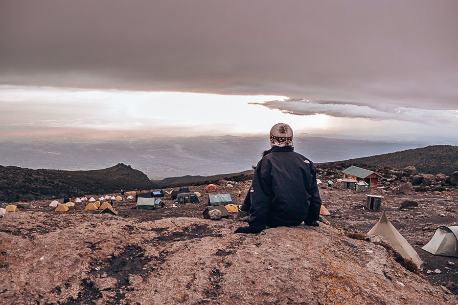
Day 4: Barranco Camp to Karanga Camp
Elevation: 13,044 ft to 13,106 ft
Distance: 5 km/3 miles
This morning, the air is brisk. I don a layer of thermals underneath my shorts and automatically pull my beanie over my ears. The temperature is dropping and clouds are rolling in. Hopefully, we won’t face rain again. All around me, I see hikers putting on long layers, yet the Africans are still walking around in t-shirts and flip flops!
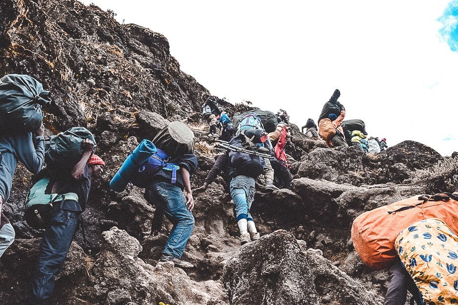
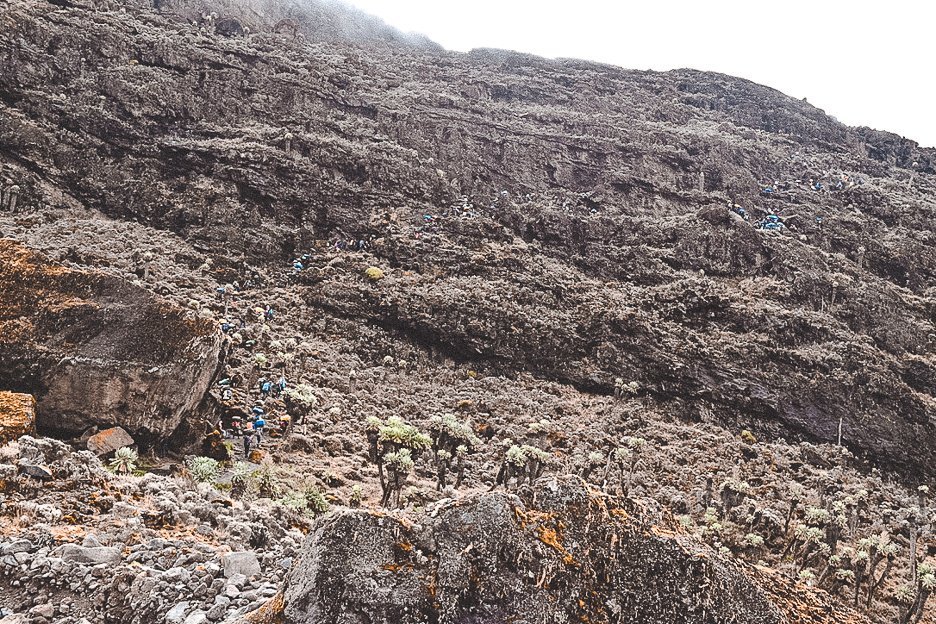
Today will be a short day for acclimatization. We’re supposedly only hiking 5 kilometres but to reach our Karanga Valley camp site, we need to get over the Barranco Wall. As we reach the foot of the wall, my mouth drops. I look up and I see porters scrambling over boulders almost as tall as an adult man. This is already impressive but what leaves me even more astounded is the fact that they’re all carrying 20kg on their back or head. Some of them are climbing in Nike slides or old Converse sneakers! I need to follow them, rock climbing in my sturdy hiking boots, with no harnesses and only 5kg on my back. It’s a full body workout and I’m grateful for every helping hand as we clamber upwards, like a conga line of human mountain goats.
When we reach the last hurdle, we’ve climbed onto a plateau. The landscape up here is what I’d imagine the surface of the moon to resemble. The rock is smooth in places, the land undulating with small mounds and shallow crevices. The terrain is relatively flat for the remainder of our hike. Mottled green heather pinprick the alpine desert.
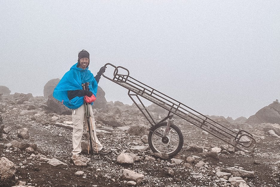
Before we reach camp, we walk past what looks like a makeshift wheelbarrow. When I look closer, it’s a bed frame on top of a single wheel with handles on each end. Jerry catches my confused look and grins “That’s the Kilimanjaro Ambulance Service.” His explanation takes a moment to sink in before he adds “No helicopter can land on the mountain. When people feel sick from the altitude, this is how we get them down the mountain.” Yikes. I pray that I won’t need to call that helpline in the next 48 hours.
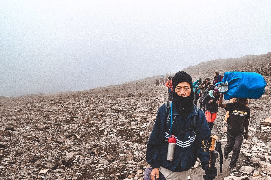
I wake in the middle of the night with a desperate urge to pee. The altitude sickness tablets must be doing their work. I’m loathe to leave the warmth of my sleeping bag but I know it’s probably best to go now under cover of darkness than wait too long in the toilet line in the morning.
I grab my torch and toilet paper. The night sky that greets me is unlike any other that I’ve seen before. It’s out here at 13,000 ft above sea level, far from the reach of light pollution, that one can truly appreciate how the galaxy dances. The black velvet ceiling is spotted with countless bright lights. The twinkling stars make me feel as if they’re performing a coordinated light show and I’m the only spectator for the evening. It’s the cold that makes me drag my eyes away from the scene above. I wrap myself back up in my sleeping bag with a vision of winking lights above me.
Day 5: Karanga Camp to Barafu Camp
Elevation: 13,106 ft to 15,331 ft
Distance: 4 km/2 miles
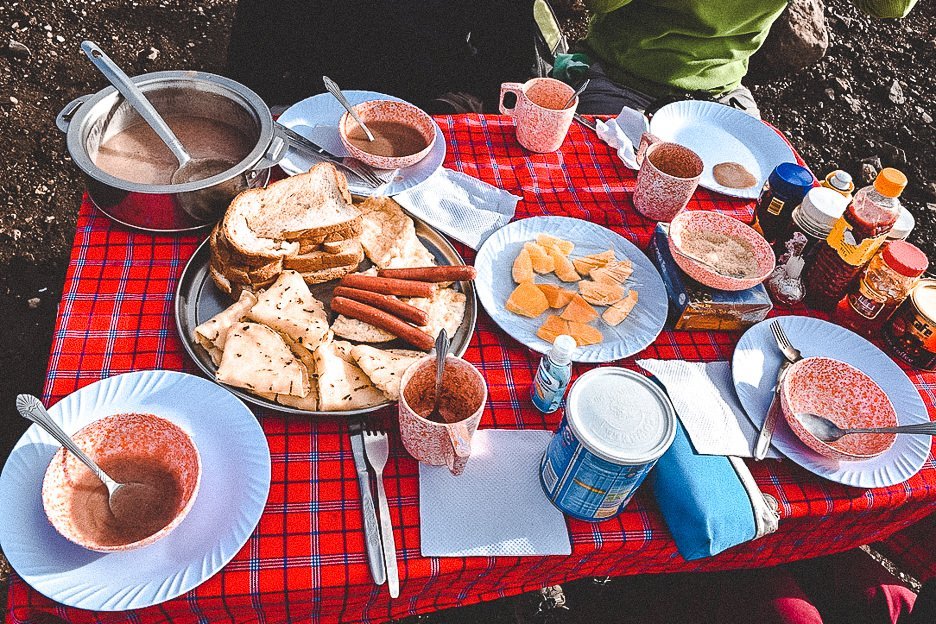
It’s Day 5. The weather gods greet us with a bright blue sky and a clear view of the summit. The group is chatty and upbeat. Breakfast consists of millet (otherwise known as ugali, an African porridge), eggs, toast, cheerios, pancakes and fruit. Again, the volume of stuff that the men carry up the mountain leaves me flabbergasted. We fuel up and pack our bags ready for the short hike. We’re heading up to Barafu Hut, which is the last pit stop before we attempt the summit. My body and mind had been tested up to here but now I was going to need to muster all my strength for what lay ahead.
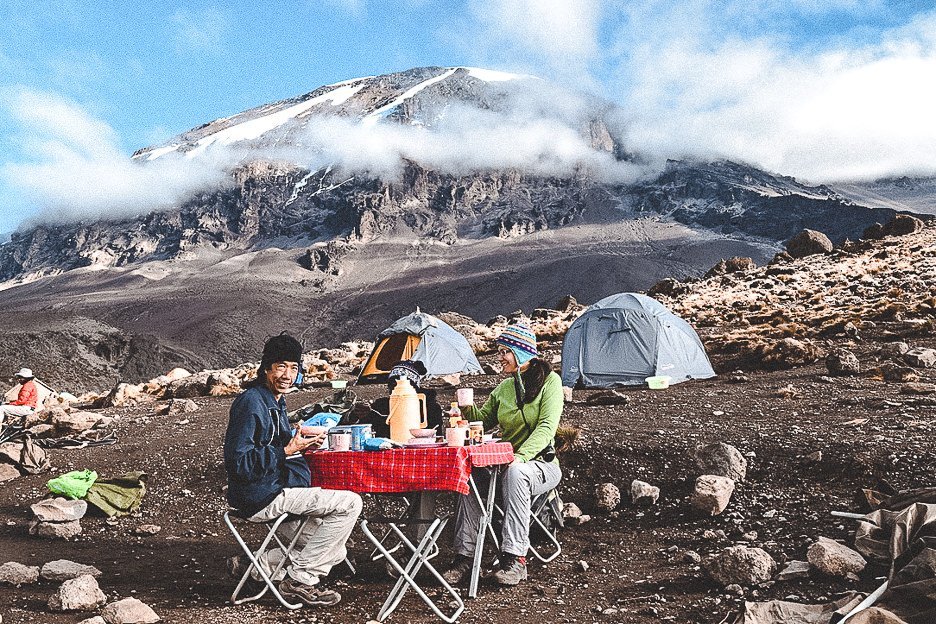
No life forms appear to exist on this part of the route. The only sounds we hear are the whistling wind and the sound of our boots crunching on gravel. Our previous campsite was the last stop for access to a water source. All the containers and our water bottles have been filled to the brim ahead of our trek to the top. Our team reach Barafu Camp just after midday. We’ve covered 4 kilometres in about 3 hours and ascended around 2,000 ft.
We eat a small lunch before packing our backpacks and preparing our clothing for the night. The instructions are to try to sleep as much as possible between 3.00pm and 9.00pm. We will start climbing at 10.00pm and aim to reach the summit by sunrise.
As I lay down, it’s difficult to fathom that I might be standing on top of this mountain come tomorrow morning. Despite the overcast sky, it is quite bright in the tent and I struggle to block out the surrounding noises to rest.
Day 6: Barafu Camp to Uhuru Peak to Mweka Camp
Distance: 5 km/3 miles
Elevation: 19,341 ft to 10,065 ft
Distance: 12 km/7 miles
Before I know it, our guides are tapping on the tents and calling us to dinner. It’s now pitch black and I fumble for my head lamp. The night air stings my skin and I pull my beanie tighter around my ears. We’re told to eat as much as possible as we’ll need the energy to get us through the night.
Our guides have shared all their tricks from years of climbing. We need to store our water bottles upside down in our backpacks as they will freeze from the top. When we turn it around to drink from the mouthpiece, the water will tip down to the ice allowing us to drink. We have snacks that are easily accessible and we’re bundled in multiple layers like an onion. I hope in this cold that I don’t smell like an onion. We pick up our poles, turn on our head lamps and we set off.
Up ahead I see a trail of lights, needle points against the black canvas. My mouth has gone dry at the thought of this massive feat ahead of us. The ascent only covers a distance of 5 kilometres yet the wind and cold at this elevation is the most extreme. We are looking to gain approximately 4,000 ft in 7 – 8 hours in the dark. Sunrise is about 6 hours away.
It’s a matter of follow the leader as guides lead their pack in zig-zag motion up the mountain. I’m walking behind my dad. I keep an eye on his boots so that I can follow his footsteps, one by one. Pole, pole.
We’re climbing through heavy scree. I’ve never travelled to the Arctic, nor do I have any desire to. But at this very moment, I feel as if I’m in the middle of the Arctic. I try to block out the cold and trepidation in my stomach to focus on not slipping on the detritus. We stop to take a short break. My puffy gloved hand struggles for my water. I wish I had managed to nab a few more hours sleep. My body is telling me that I should be lying flat on a mattress, not climbing a mountain in the middle of the night at almost 5,000m above sea level.
I swing my backpack onto my back and grip my hiking poles tightly. Pole, pole. I’m moving and propelling myself forward, yet it feels like I’m moving slower than a snail. I’m frozen to the bone. I’ve never felt this cold in my life. There are no trees nor giant boulders to shield us from the wind that lashes against our bodies and cuts any inch of exposed skin. Condensation from my breath against my balaclava seems to freeze almost instantly as I breathe out warm air to keep the feeling in my nose.
At one point, I stop and lean on my hiking poles. I’m utterly spent. All my limbs are numb and my energy reserves depleted. “Come on Miss Jasmine!” urges Jerry. “You can do it! Pole, pole! Let’s do it together.”
“No, I can’t”, I think to myself. “I’m so cold. I can’t do it.” I burst into tears. I’ve realised that I had no idea how hard this would be – physically and mentally. I feel weak and naive. My mind is racing. “Why didn’t I do more research? Why didn’t I train those extra days with Dad? Why did I think I could do this? Why did I ever agree to come on this bloody trek?”
I blubber to my dad that I can’t go on. I can’t feel any part of my body. I can’t do this anymore. I want to go home. I swear Jerry told us 2 hours ago that we would be at the top in 2 hours. Has our progress really been that slow? It’s a good thing I can’t see our path in the dark as the summit would truly feel insurmountable. It already feels impossible. I’m not the only one struggling. My fellow female mountaineer seems to be stopping as many times to catch her breath. Maybe it will be the two of us who won’t make it to the top. The 2 hours that our guide predicted has clearly stretched out closer to 3 hours.
Somehow, I’m convinced to keep moving. At a point where I seem to have found a rhythm by counting my steps in bands of eight, the horizon grabs my attention. The sun is rising and casts a mystical glow over the clouds. We can see that we are above the clouds and for a moment, I can appreciate how far we’ve come. How far I’ve journeyed to get to this point. Eventually, we reach a boulder and our guides band us together. “Well done everyone. This is where you must decide if you will continue to the summit, or turn around to go back to camp”. Sleep is what I want right now. I’m convinced that I’m going to go back down. Stuff this mountain climbing thing. All I want to do is lie down and turn into Sleeping Beauty for a few days. To my surprise, the American girl has found a second wind. She’s decided she’s going to keep going to the summit. I’d heard stories of rookie climbers not making it to the summit on their first attempt. Was I going to be one of those rookies? Something in my mind clicks and I’m 99% certain it’s FOMO kicking in. Screw this – I’m not going to be only person out of the four of us to not make it to the top! Let’s do this!
The sun climbs higher in the sky. We can see the trail ahead of us now. Not too long after, a wooden sign emerges over a crest. “We’re there! We made it!” I think to myself. The elation soon subsides as I discover we’ve actually reached Stella Point. This was the station that we were meant to reach by sunrise. Streams of climbers now overtake us at Stella Point, eager to reach the peak as quickly as possible. I honestly don’t know how, but I manage to make my legs trudge forward. Hikers are coming towards us, on their way down. They shout a cheery “Merry Christmas!” and “You’re almost there! Keep going!”. It’s the boost my spirit needs.
The sky is practically cloudless. The wind’s bitterness seems to have dialled down a notch and we can feel the sun on our backs. As we reach the last ridge, we now have full view of the Rebmann and Ratzel glaciers. My dad snaps a quick photo but our guides keep spurring us on.
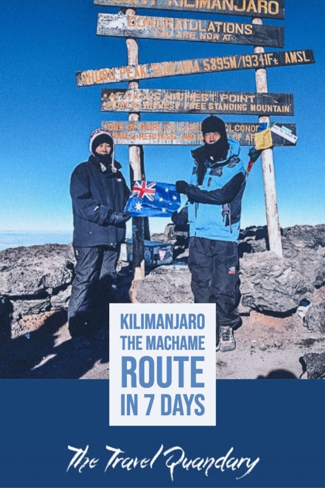
Finally, we reach Uhuru Peak. Excited adventurers are clambering on the sign getting their photos taken. I take my backpack off and slump onto the ground. I did it. I’m actually bloody here! On the top of Mt Kilimanjaro! How the hell did I do that?
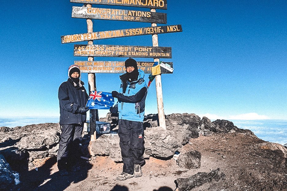
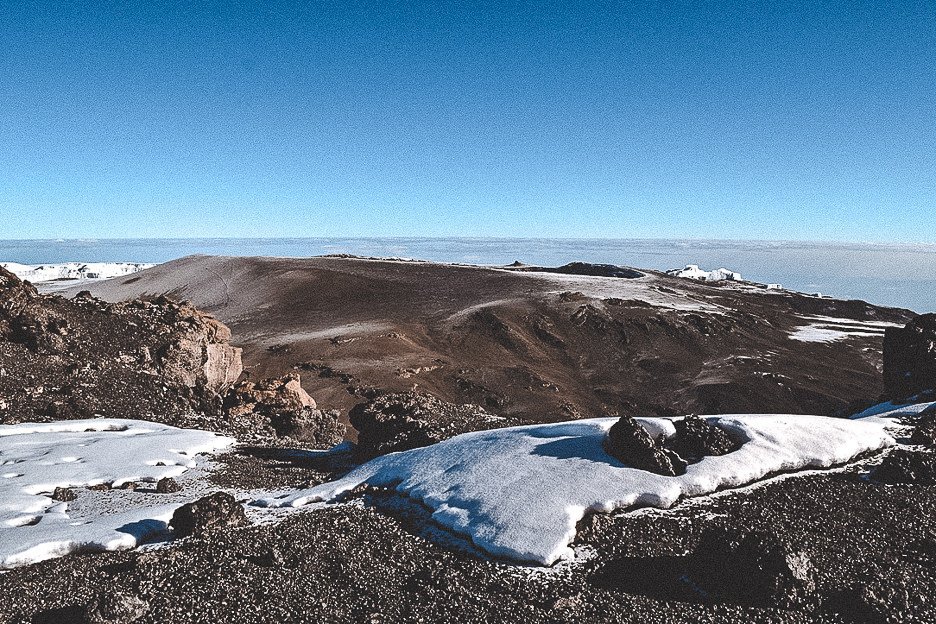
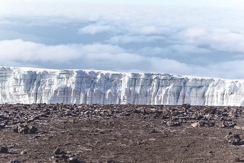
The next ten minutes are somewhat of a blur. I remember holding the other side of an Australian flag and squinting into the sunlight. I recall colourful flags draped around the sign and shrieks of delight and high-fives going around. My eyelids are drooping. One of our guides is scooping me up off my feet. I don’t even remember sitting back down on the rock. “Time to go, Miss Jasmine.”
The guide is holding my gloved hand, leading me back down the trail. There are stragglers still making their way up to the peak. “You mustn’t fall asleep Miss Jasmine. You have to walk down to the camp now”. I’ve started to feel a bit dizzy. Up until this point, I was having no trouble handling the altitude. It’s decided that Tommy is going to lead me down the mountain to get to camp as soon as possible. Jerry will accompany the other three down, including my dad. Soon we’ve gone “off-piste”. It’s half snow, half gravel and we’re clearly not following any path. Tommy is sliding down on his own two feet with ease, then pauses about 100 metres waiting for me to awkwardly tumble down to meet him. He’s even carrying my daypack and I can’t keep up with him. “Don’t stop Miss Jasmine. You must keep moving”. Each time I reach him, I’ve barely caught my breath and he’s off again. “Must keep going down”. What happened to “pole, pole” I mutter to myself more than once.
After what feels like eternity, we make it back to Barufu camp. A cheer goes up from the porters. I manage a faint smile before diving into the tent, removing my boots as quickly as possible and collapsing on the mattress. Sleep consumes me.
A few hours later, my dad is shaking me awake. I haven’t heard the calls from the guides. It’s time for lunch and then we have to descend another 5,000 ft down the mountain. We’re not sleeping here tonight. After over twelve hours of physical exertion, my whole body is screaming for more rest. We’re hurried along as we’re told it’s going to rain so we need to get a move on.
We’re one of the last groups to leave the campsite. We’re coming down the Mweka trail. Here, the path is rocky and there has been evidence of heavy rain. Jerry has taken my day pack and I focus on navigating my wobbly legs downhill. I’m convinced my knees won’t hold me up any longer and I grimace with each step. I’m worried that this mountain has ruined my netball career and that I’ll need at least one knee replacement when I get back to Australia.
Our last dinner on the mountain is brief. After exchanging a few congratulatory smiles and high-fives, we slump exhausted into our tents.
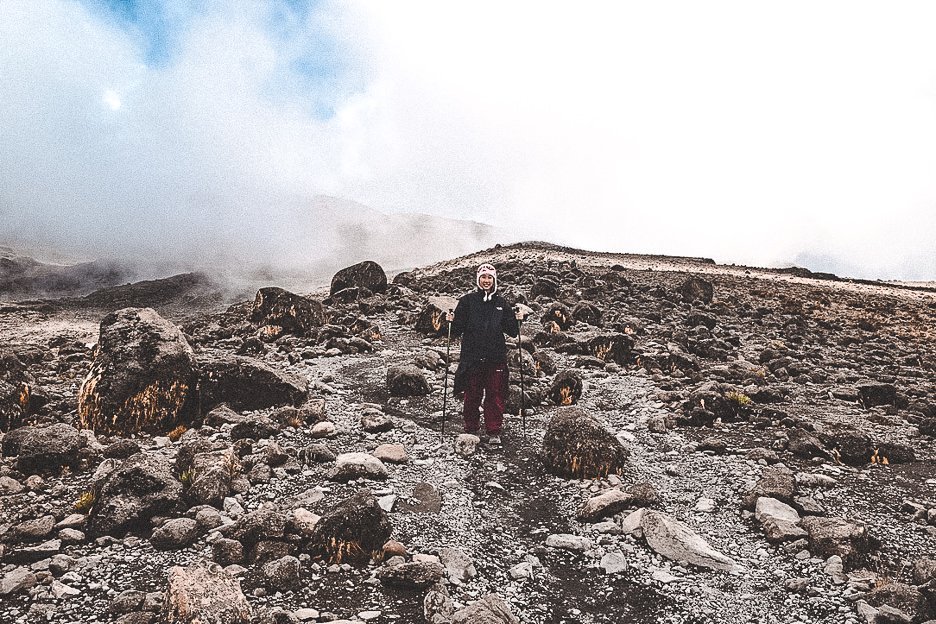
Day 7: Mweka Camp to Mweka Gate
Elevation: 10,065 ft to 5,380 ft
Distance: 10 km/6 miles
It’s our last day! I am overjoyed at the thought of hot running water and clean clothes.
Before we set off, Bobby and Jerry gather us together with our porters. Here, our guides add their congratulations and thank us for a successful expedition. We’re treated to a song and dance by the group of joyous men who have supported our journey up and down Kili. With one final whoop and cheer, we shake hands and exchange smiles with each porter before they set off with one last wave.
After about an hour, we reach the edge of the rainforest where the thicket of greenery becomes bushier. I’ve reclaimed feeling in my fingers and can remove my gloves. Sunlight streams through the canopy and the air becomes more moist. Soon, we’re able to remove our heavier jackets.
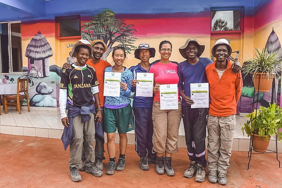
In the last part of the trek, I stick in my headphones and try to ignore the throbbing pain in my knees and feet. I don’t think the magnitude of my accomplishment has completely sunk in yet. It’s not until we reach Mweka Gate and the wooden Congratulations! sign that I break out into a huge smile and breathe a sigh of relief. I made it. I actually bloody did it. I summitted Mt Kilimanjaro. And made it back down again in one piece.
It feels somewhat surreal as I receive my summit certificate. From thinking I couldn’t make it to standing on the peak of Africa’s tallest mountain – what a tumultuous 7 days! As we’re ferried off back to our hotel, I catch a glimpse of the peak. I stare wondrously at Kili, standing firm and unwavering. It’s funny how much climbing a mountain can teach you about your ability to push yourself to your physical and mental limits. For any hiking enthusiasts, Mt Kilimanjaro can certainly be called one of the best hikes in the world. This last week was certainly the ultimate test of physical and mental strength, endurance and resilience. I sink into my seat, grateful for the cool air rushing through the car window, a tired smile on my lips. In days to come, I’ll be proud of my tenacity and the fact that I pushed through the cold and exhaustion. But the only thing I want right now, is a push towards a shower and a pina colada next to the ocean.
Are you a mountaineer or hiking enthusiast? Share your adventures with us in the comments below!
LIKE THIS POST? PIN IT AND SHARE IT!
